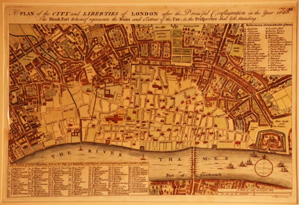
Map detailing the devasted areas of London following the 1666 fire

post 1666 map


I am very grateful to Patrick Mannix at MOTCO Enterprises Limited both for his permission to reproduce the following images of 
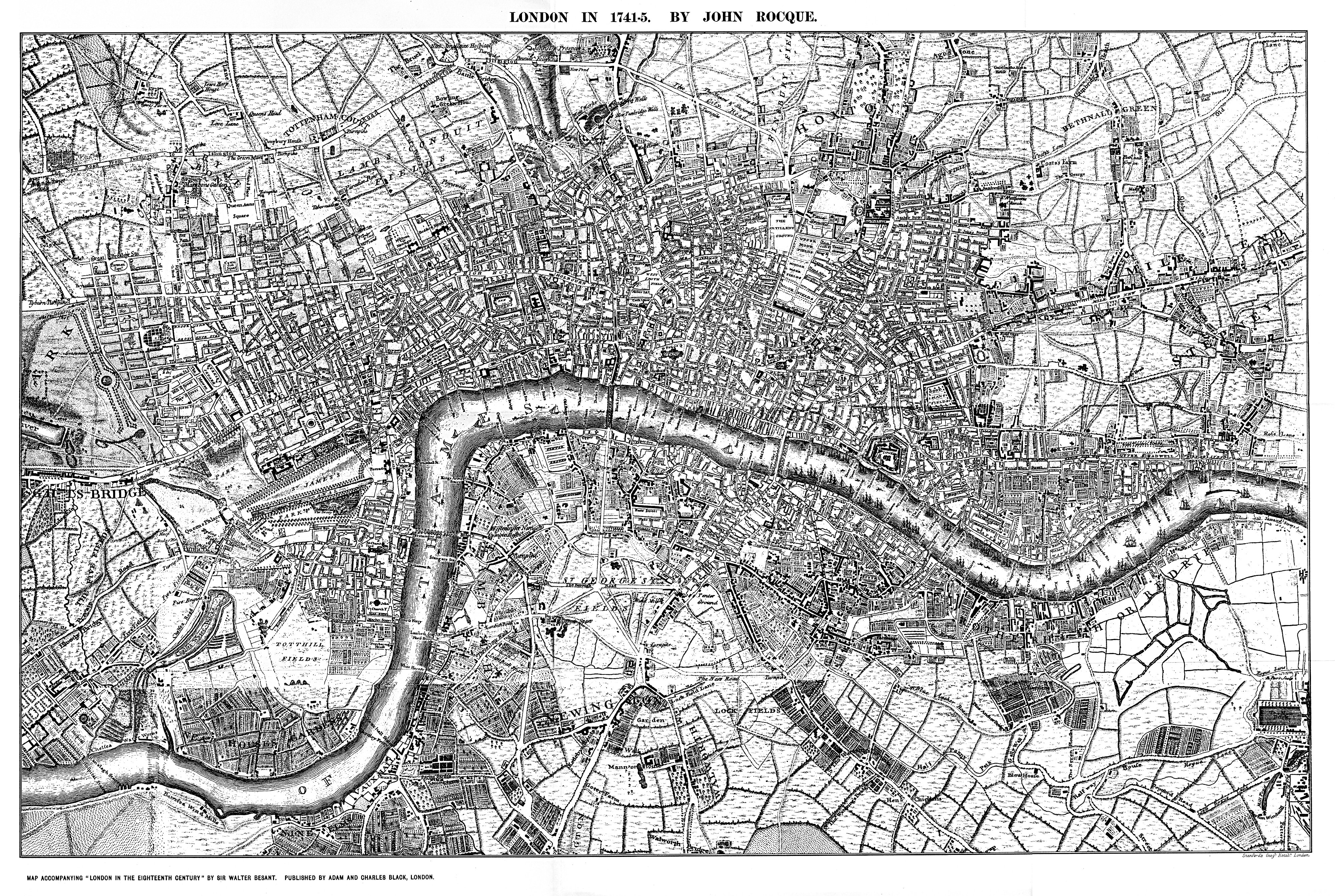
John Rocque's 1746 map of London, Westminster & Southwark covering the period 1741-45, Richard Horwood's map of London in 1799 andforidentifying other relevant maps. These maps and others are available from the Motco website at www.motco.com.


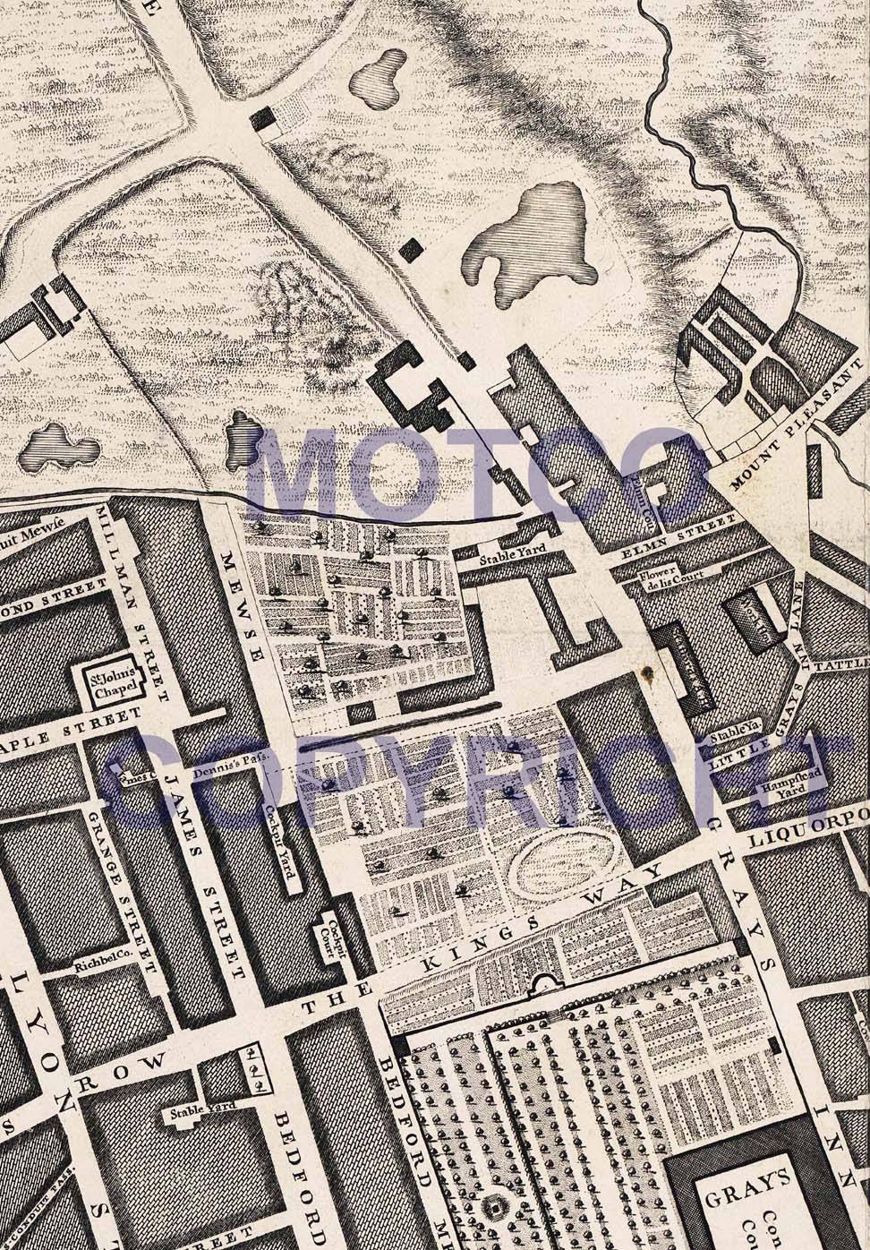
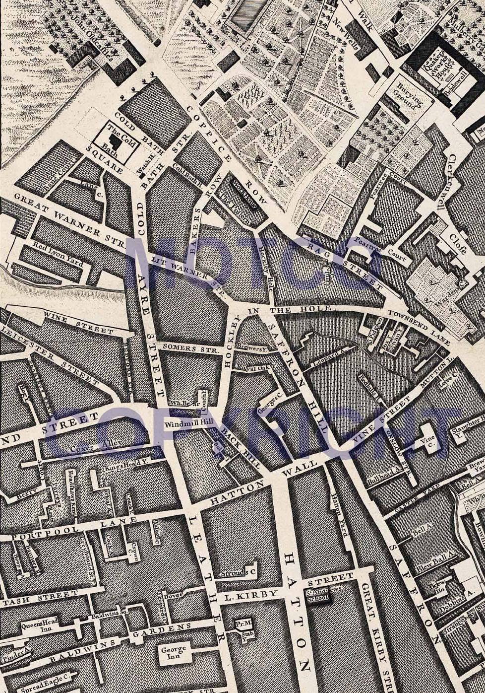
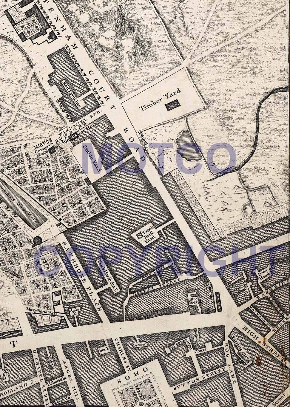
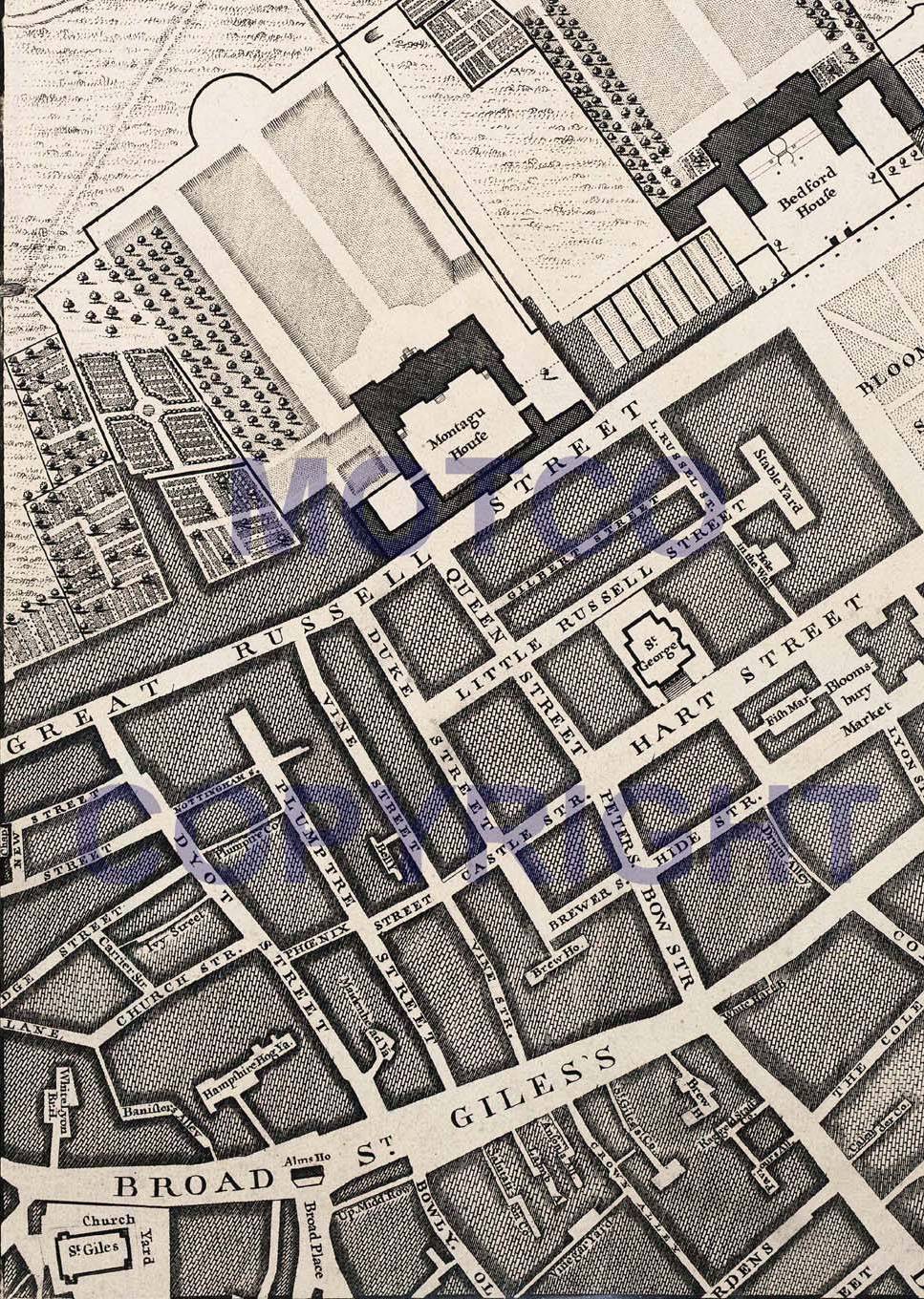
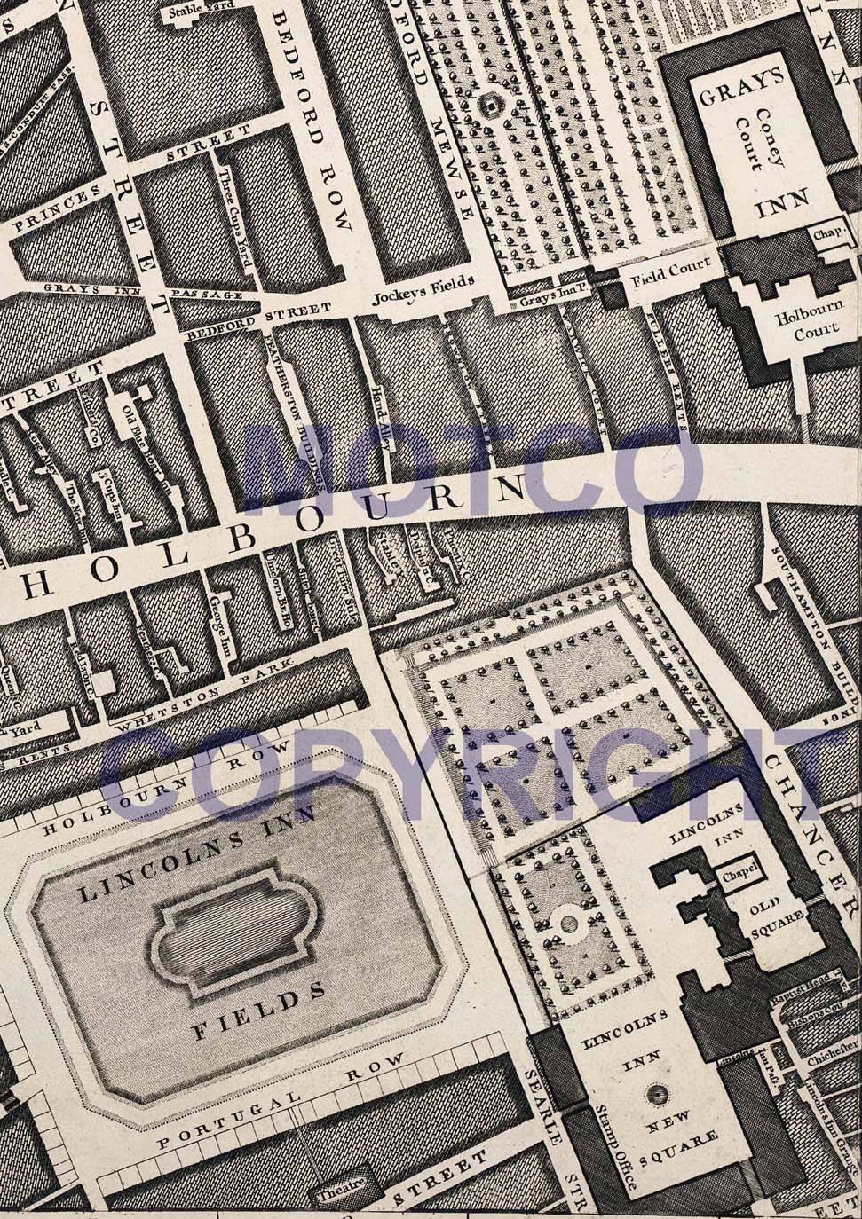
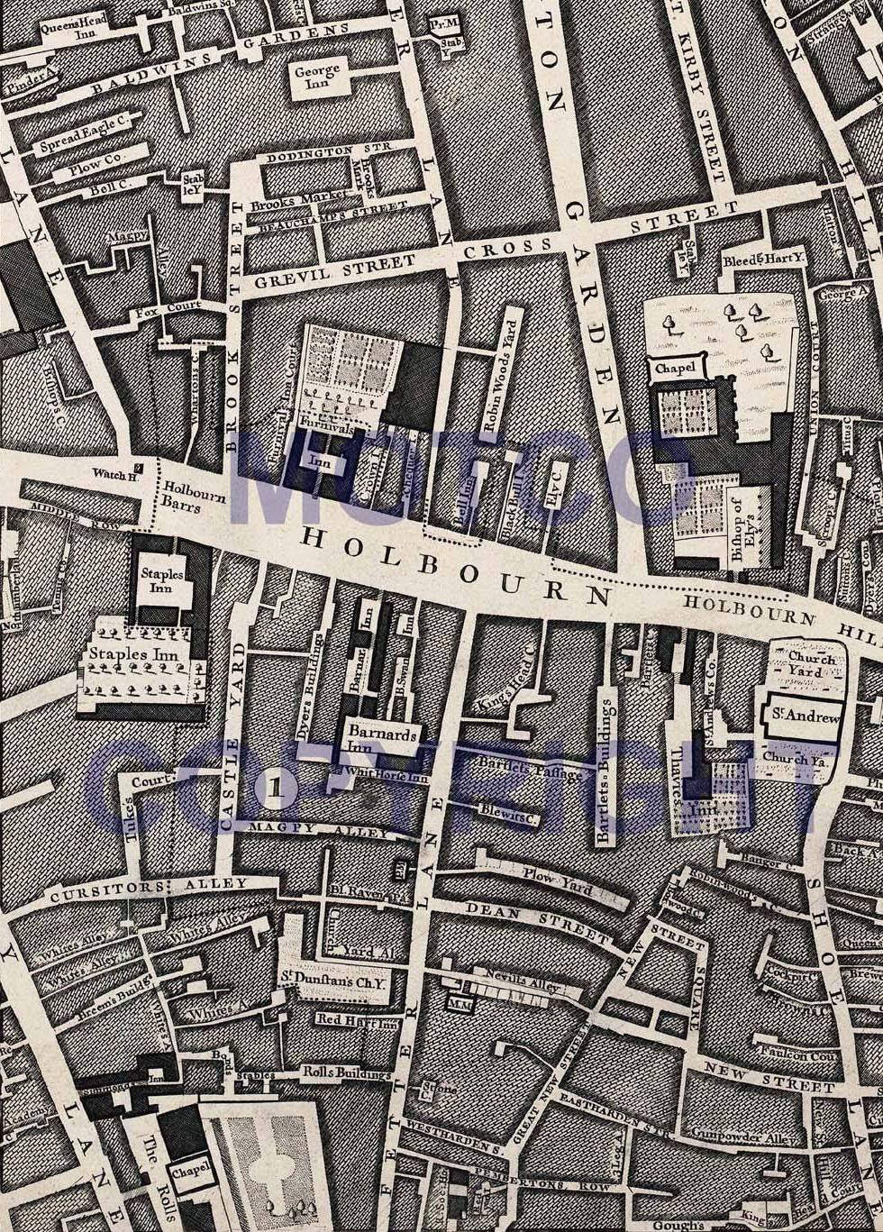
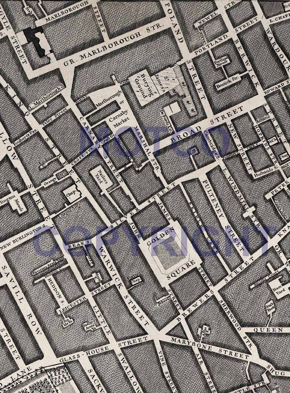
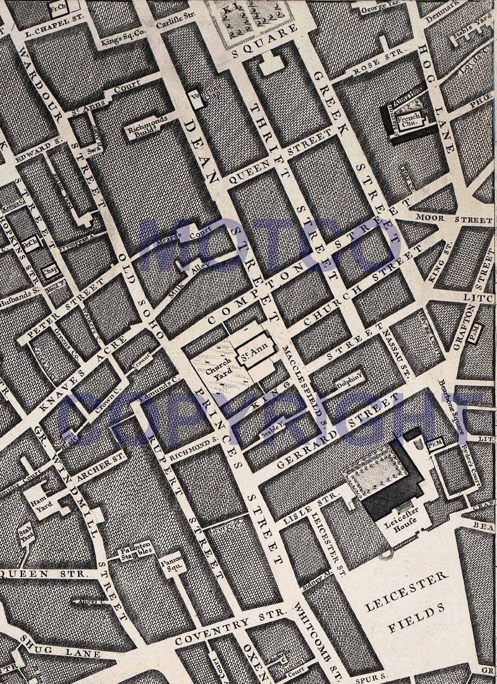
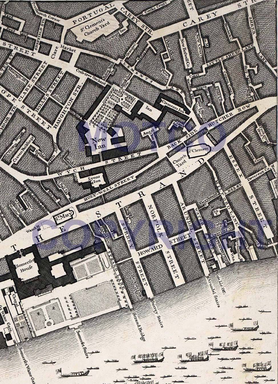
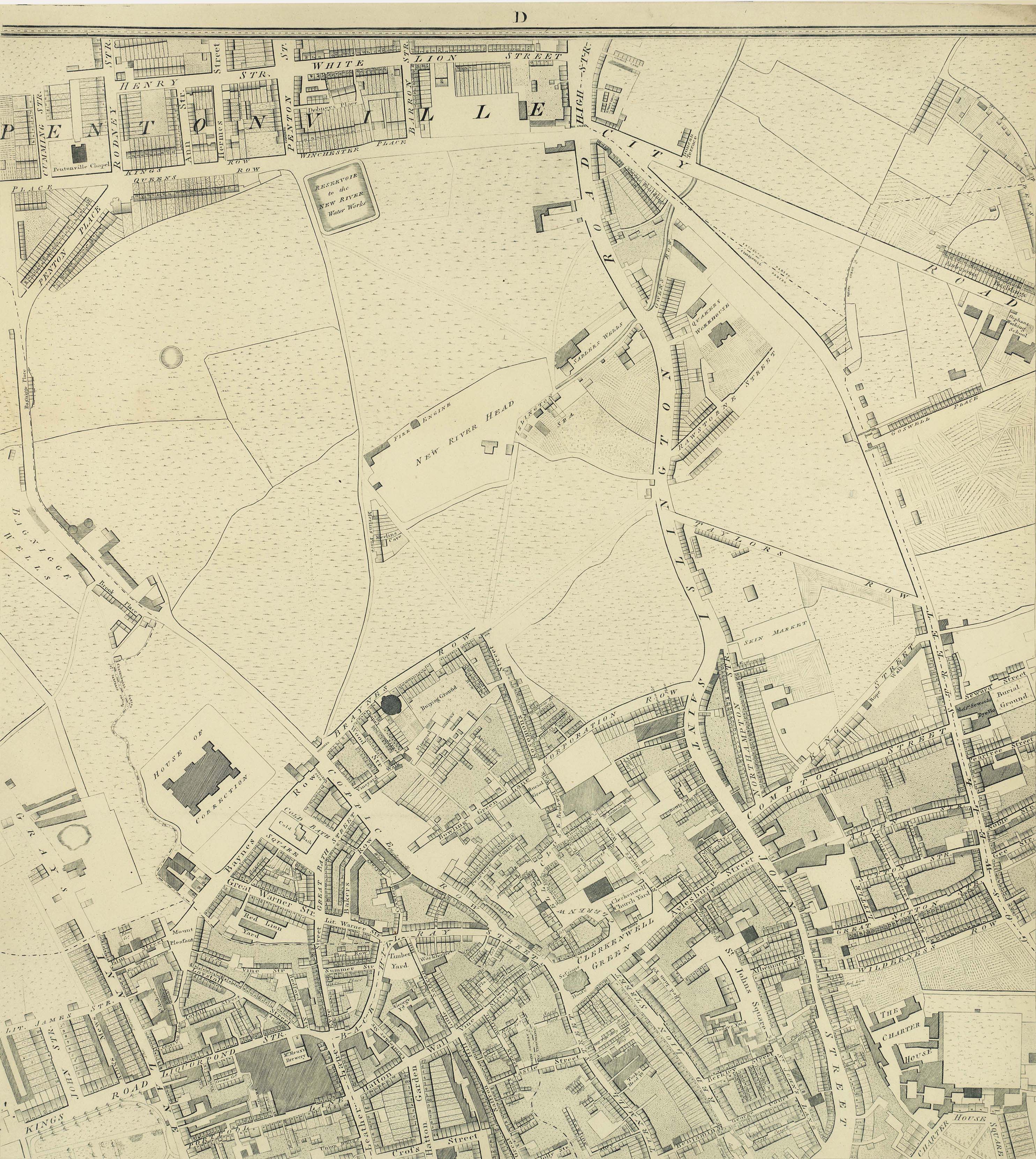
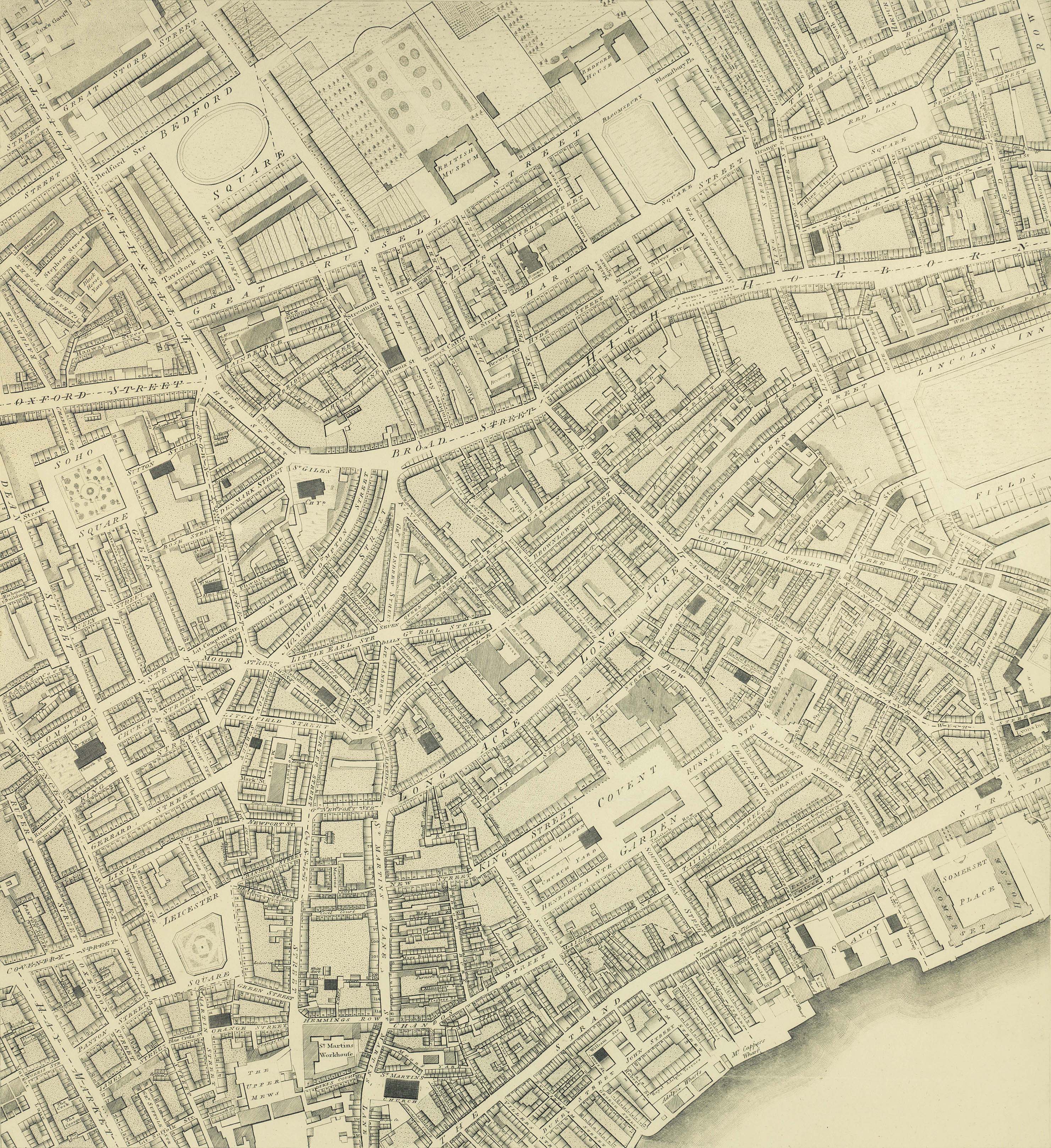
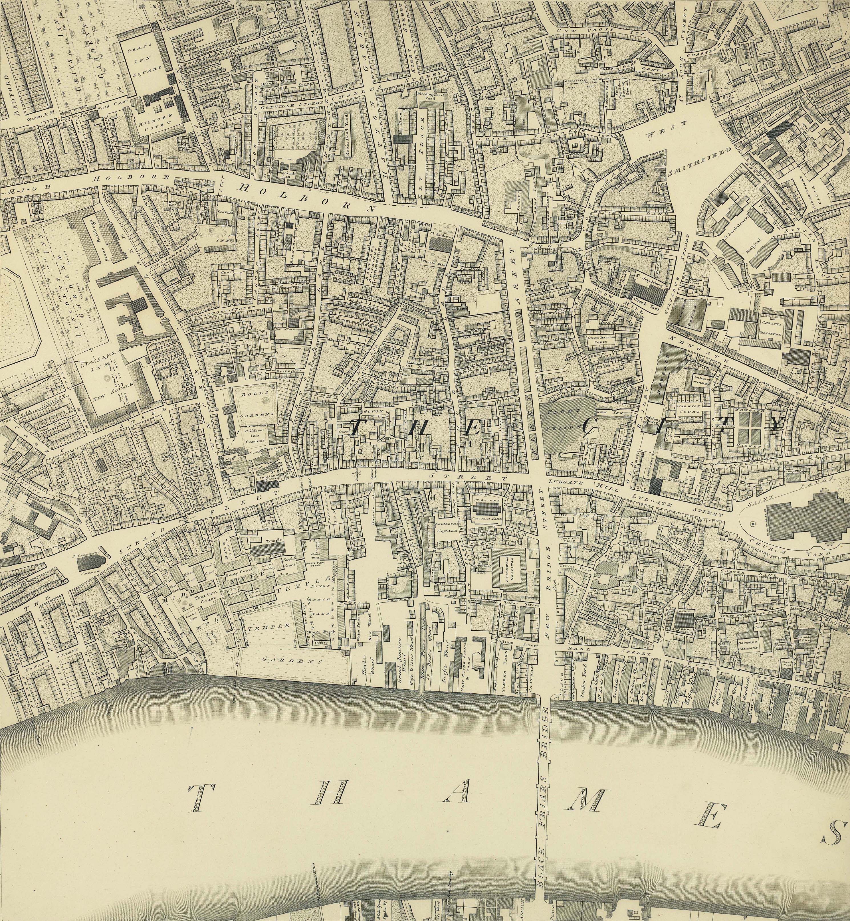
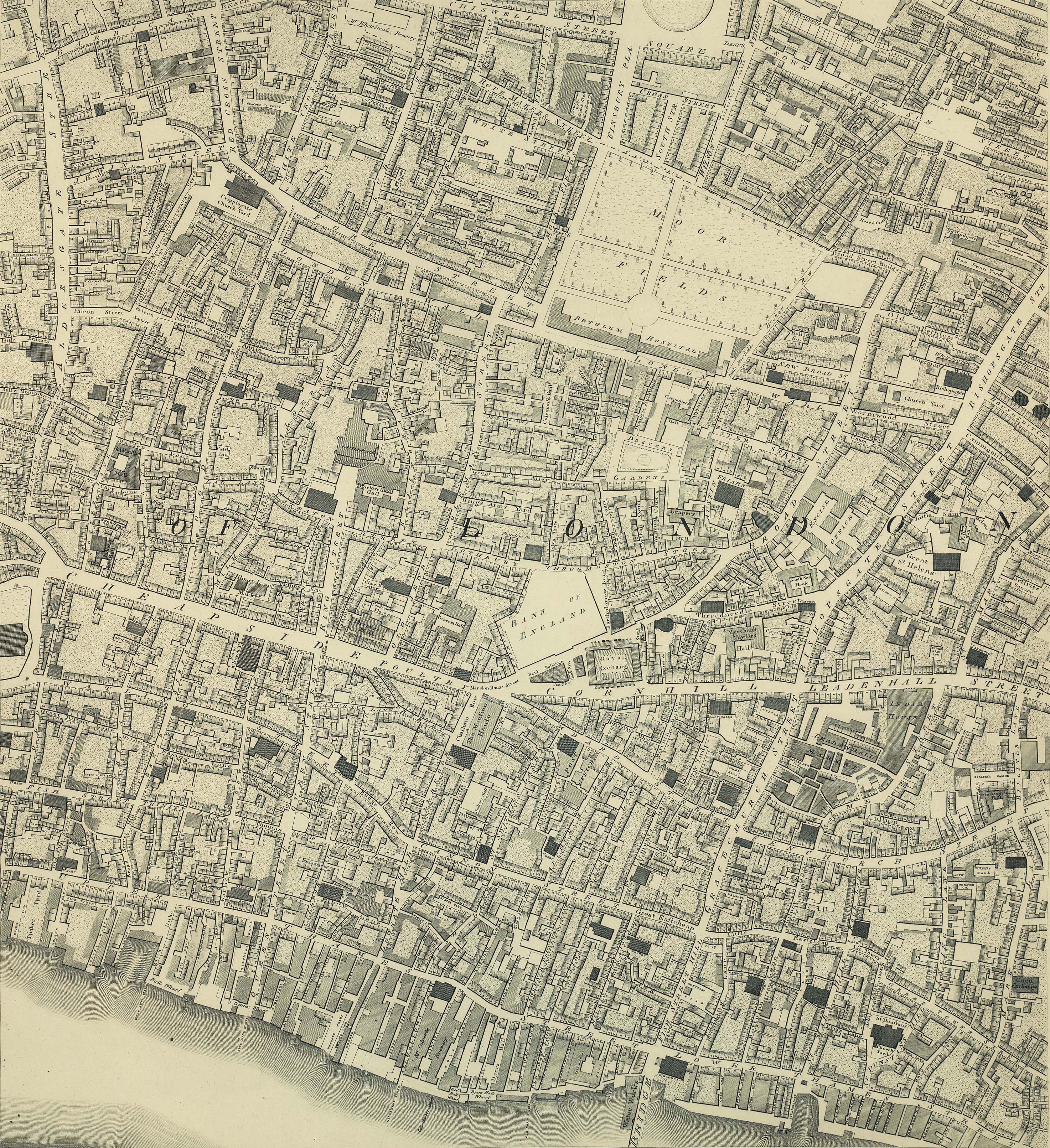
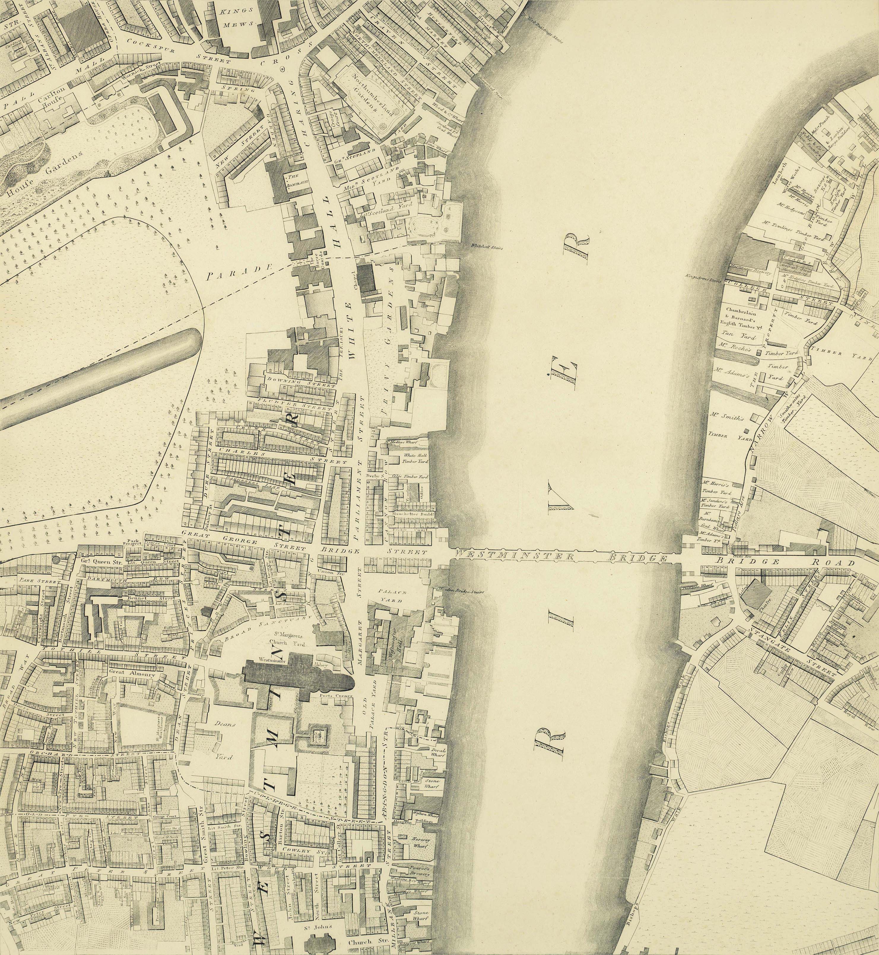
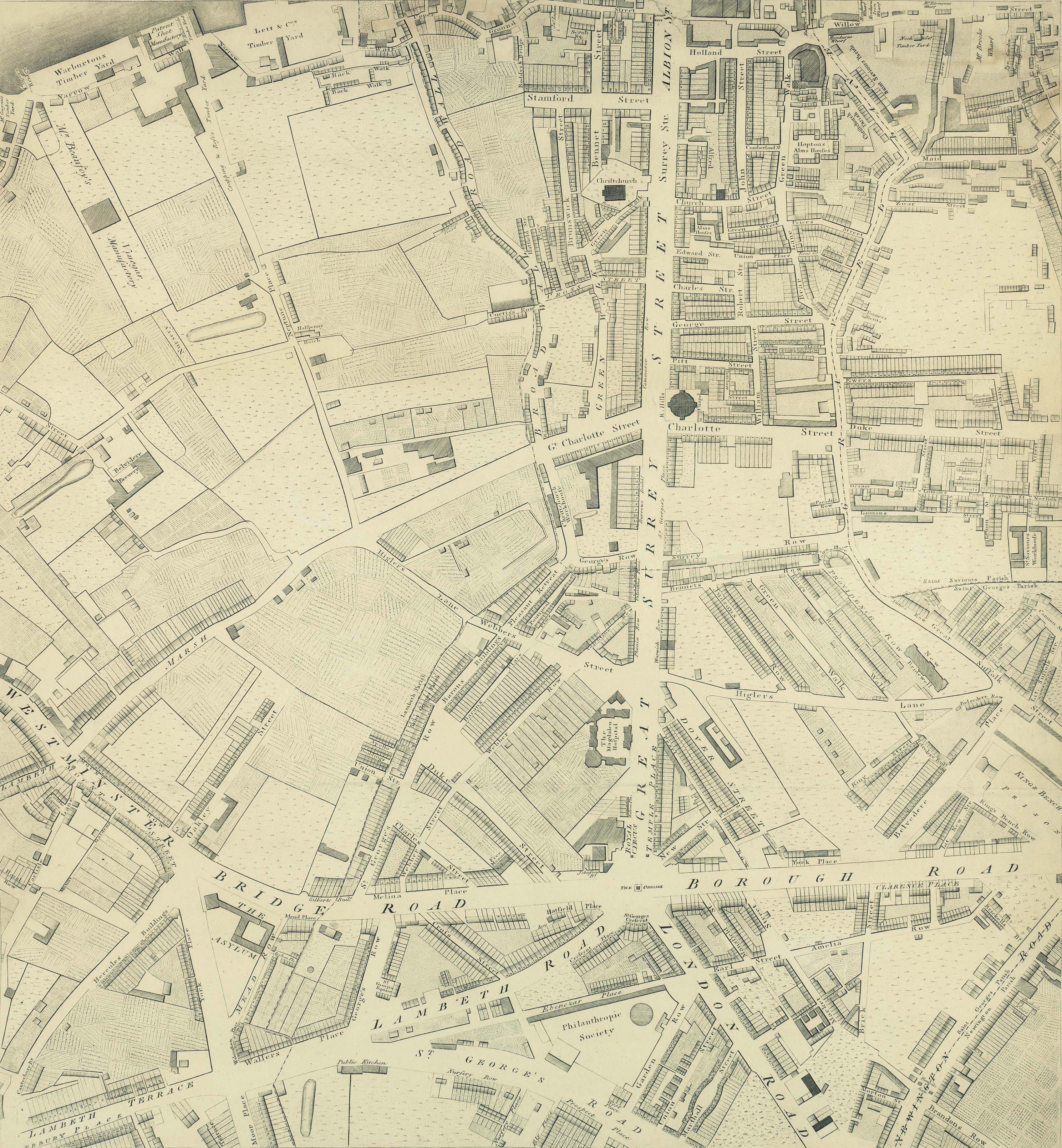
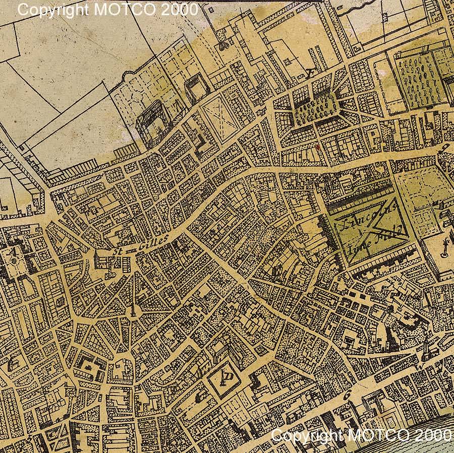
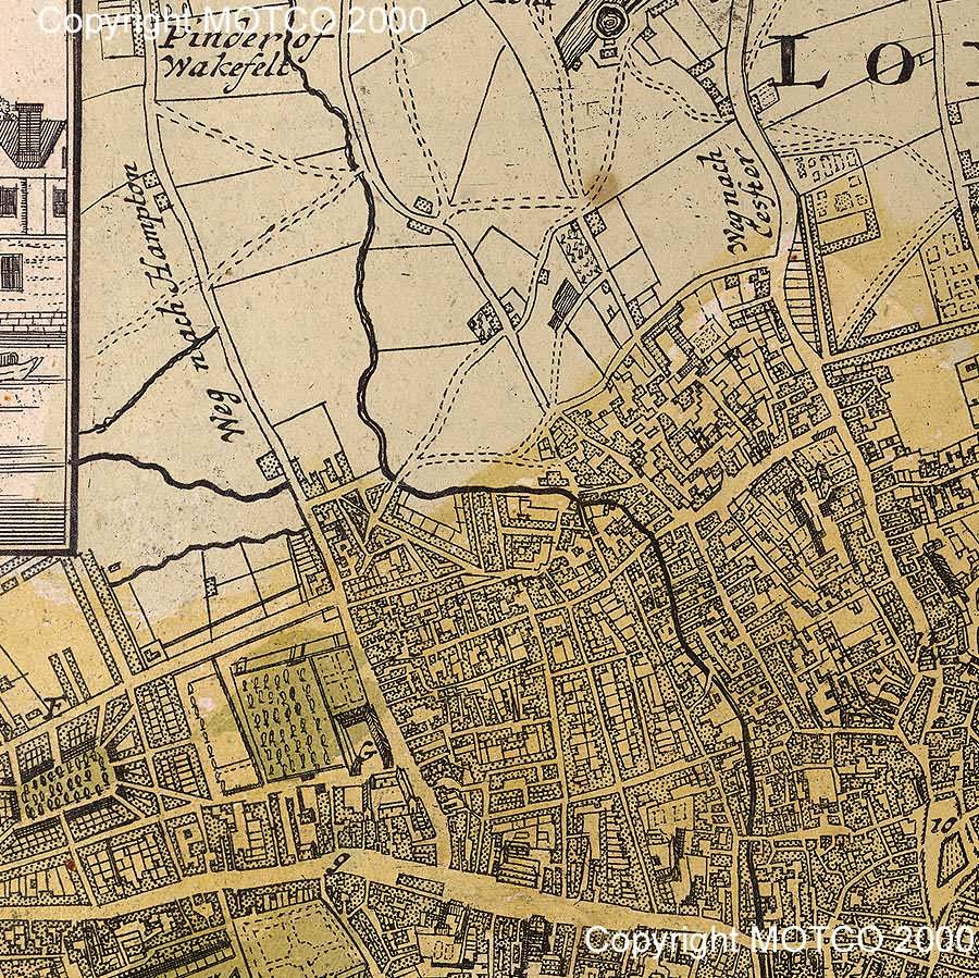
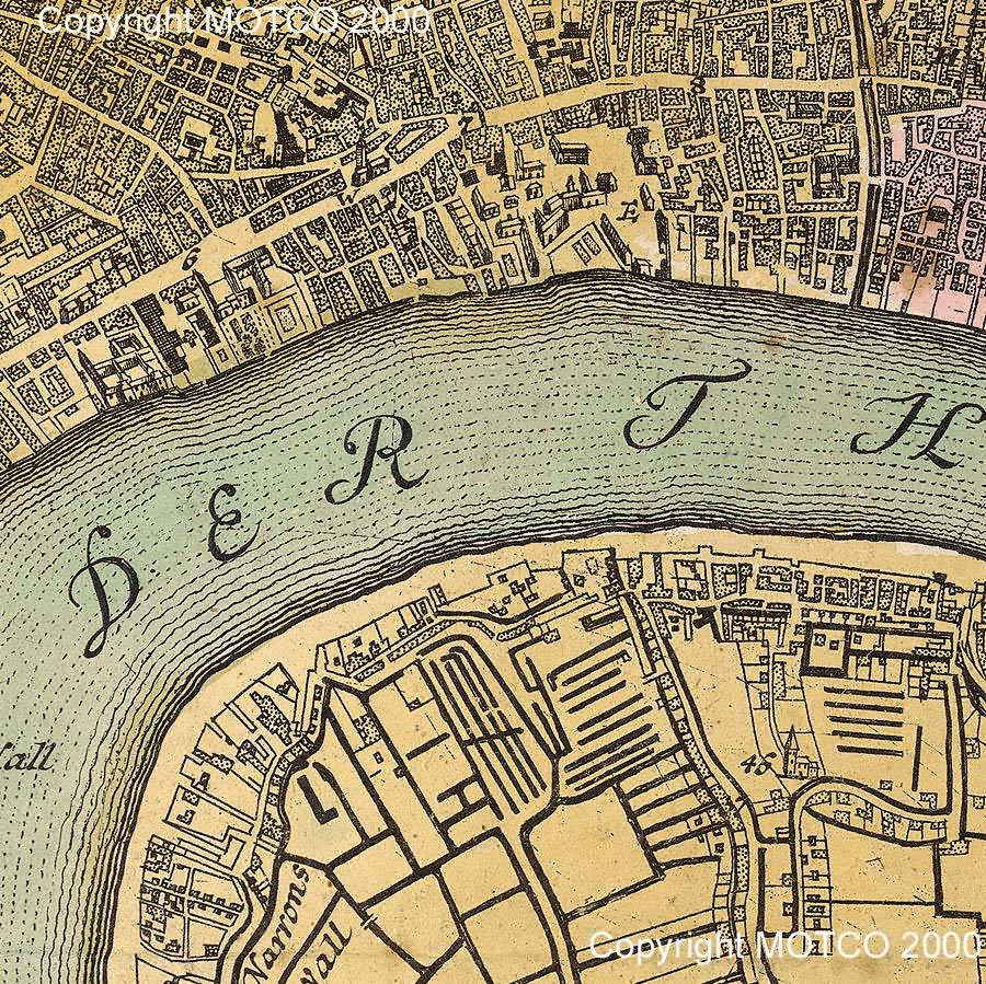
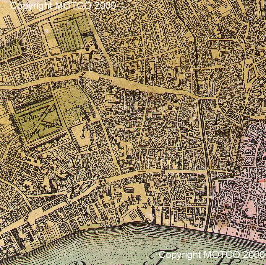
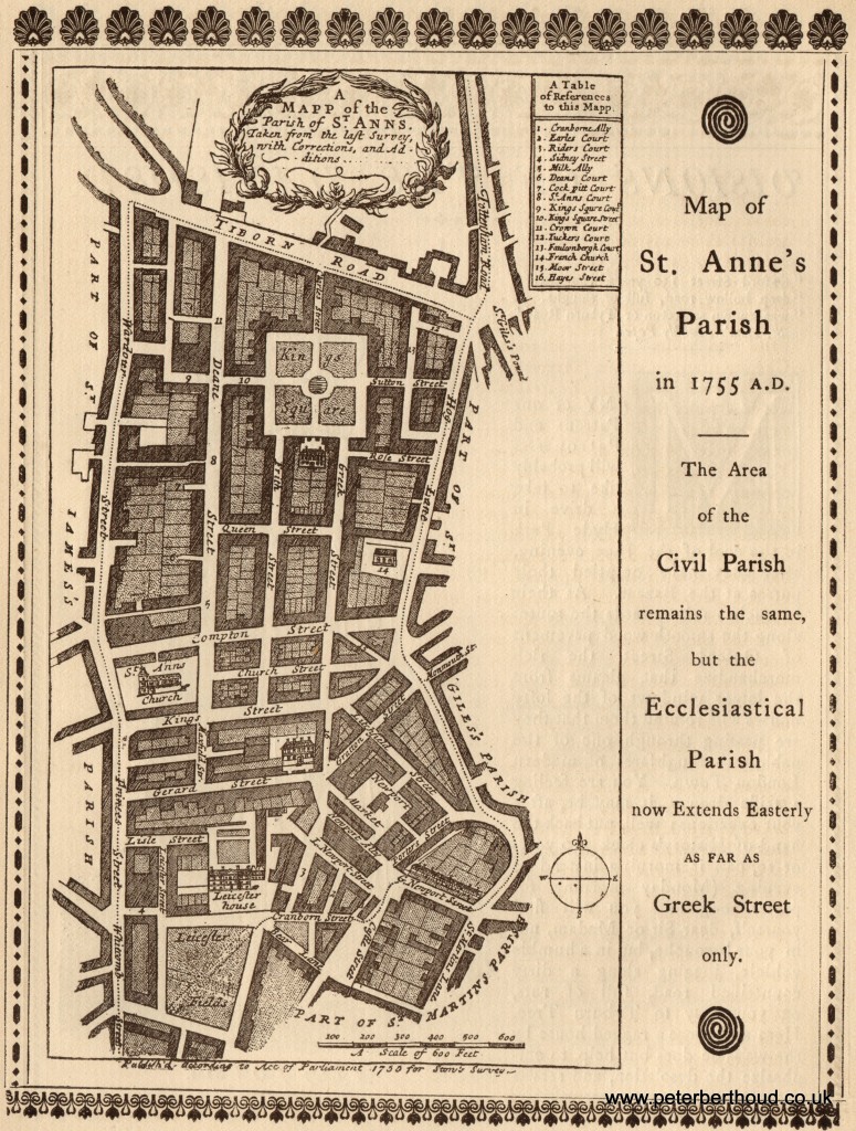
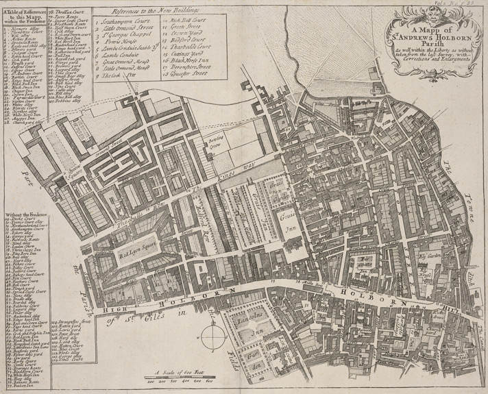
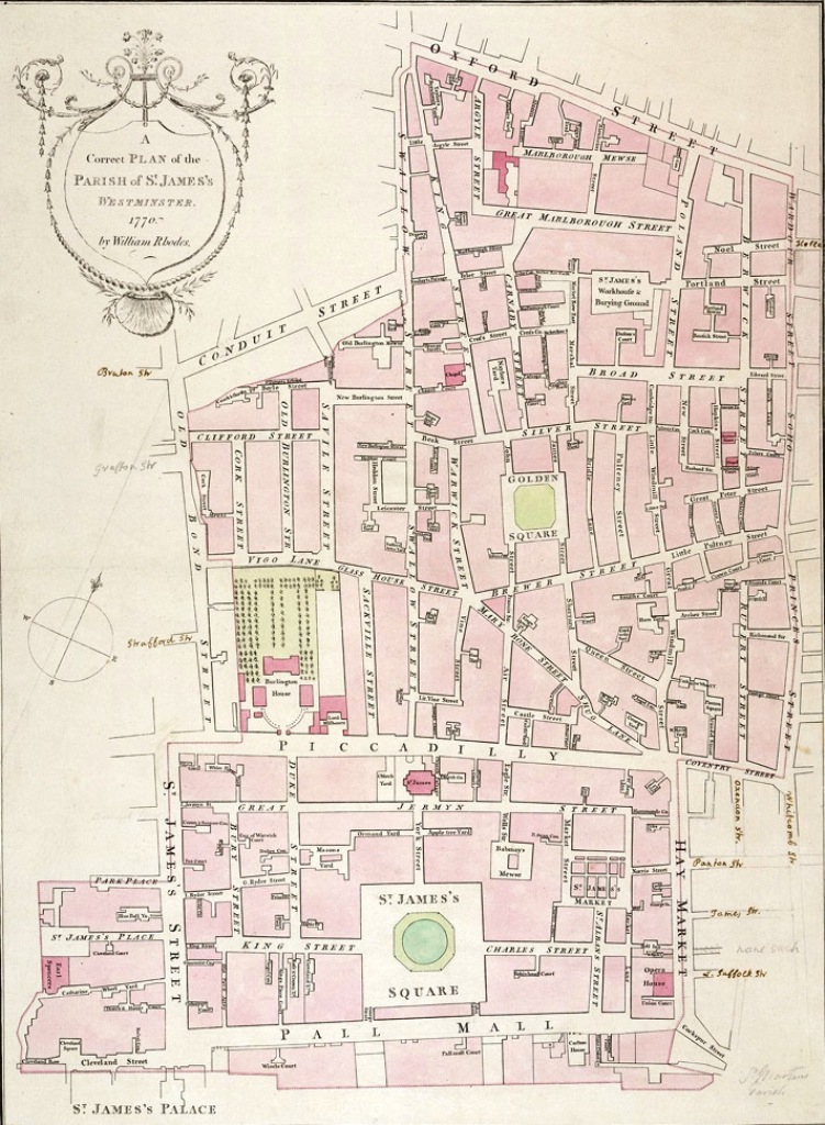
We are so fortunate to have access to a map that was made exactly at the moment when our family apparently first surfaced in London. Many of those roads still survive, albeit changed beyond recognition save for the distances between them. Firstly there is an image of the entire map. Not all the segments are relevant to us, I've included some just to show the size of London in 1745 and 1799 compared to the capital at the start of the 21st century. Itseems unbelievable today that our first ancestors could have strolled through nearby fields when they were living in Soho. There are some addresses that I haven't included because those segments are on the edge and wouldn't have fitted into the screen. In some instances the borders of each panel overlaps its neighbour by a small margin.

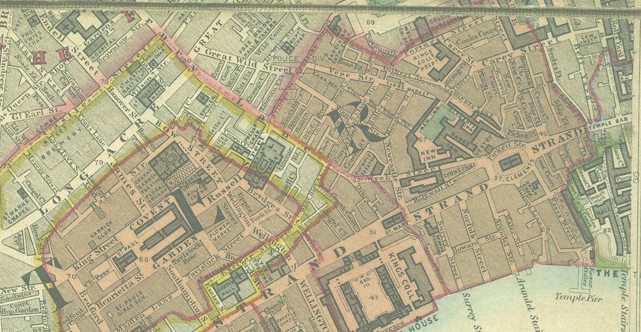
The John Rocque 1745 map is followed by an identical table of panels, each of which contains addresses directly associated with the early Gauberts. The Horwood 1799 map is even more helpful to our family because it shows the house numbers.


john rocque's map of london 1741-1745


Click on any panel below to enlarge the image


        r04nnorth r03nnorth
r08north r07north r06north r05north r04north Baldwin Gardens 1746
r08south r07south r06south r05south r04south r03south

ro8lsouth


        Tash Str (part) Tash Str (part)
Berwick Str part) Soho Square (part) St Giles (part) Fisher Str, Red Lion Square Chancery Lane (part) Baldwins Gardens, Chancery Lane (part), Fetter Lane (part), Fleet Str (part)
Berwick Str (part), Brewer Str Bateman's Buildings, Bateman Str; Carlisle Str, Litchfield Str (part), Soho Square (part) Litchfield Str (part), Porter Str, St Martins Lane Dukes Court, Drury Lane Great Shire Lane, Serle's Place (area of) Chancery Lane (part), Fetter Lane (part), Fleet Str (part)
Castle Str          


Berwick Street is described by Strype in 1720 as a 'pretty handsome street, with new built houses and inhabited by.the French, where they have a church.' The Church mentioned would have been the Ancienne Patente of Soho - from Beeman in his 'Notes on French Churches in London' (Hug. Soc. Proc.,vol. viii, p. 42).


Richard Horwood's Map of London in 1799

Click on any panel below to enlarge the image


    d1
 
b2 c2 d2 e2
b3 c3 d3  
 
Edward Stanford's Map of London 1862- 6, Serles Place, Lincolns Inn - one of the earliest Gaubert addresses. The home of Peter and Edward Gaubert during the period 1774-1829
stanford map 1862
 
serles place 1862


Ann Gaubert (daughter of John & Mary Gaubert, born in Ormond Street, baptised on the 10th April 1708 at St Andrews church in Holborn) and her family would have known the streets depicted below in sections of Johann Baptist Homann's map of 1705
map nehol 1705
map 1705 swhol
MAP 1705 ehol
   
1705 homann map of lincolns inn
   
st ann 1755
St. Anne's Parish 1755


1720 Map of Holborn Parish showing Great Shire Lane which is North from Temple Bar to Carey Street, the south-eastern corner only being in Farringdon Ward Without, the remaining portion lying outside the City boundary (Elmes, 1831). Other names : "Sheere Lane" (O. and M. 1677). "Shyre Lane" (S. 375). "Shear Lane or Shire Lane" (Strype, ed. 1720). "Lower Serle's Place and Searle's Place (O.S. 1848-51). So called because it divideth the Cittie from the Shire (S. 375). Named Serle's Place after Henry Serle, whose arms are over Carey Street Gateway. From: 'Great Prescott Street - Great Swan Alley', A Dictionary of London (1918). URL: http://www.british-history.ac.uk/report.aspx?compid=63151 Date accessed: 03 October 2013.

1720 map of holborn parish

1770 Map of St James

1770 map of st james>


norwood place


The above map shows Norwood Place, off Bedford Place, in what is now Kensington Church Street, London. Alfred, son of Edward, gentleman & Elizabeth (nee Robinson) was born at No. 1 Norwood Place on the 8th January 1841.  Edward's sister Marian was also born there on the 21st May 1843. Below is a 21st century photo of 1, Norwood Place which is now 99, Kensington Church Street. This photo and the accompanying text is taken from an edition of the Kensington history group publications.

"Guest writer Cecila Mann provides an in-depth history into her family who used to live at No. 1 Norwood Place, which is now known 99 Kensington Church St.

In 1877 the family moved to No. 27 Ball St. near Kensington High St. where they lived until 1880. However not a vestige of Ball Street remains due to the site being cleared for the development of Barker’s Emporium (now the site of Whole Foods Market).

Michael, Catherine and their children moved a short distance away to No. 1 Norwood Place, off Bedford Place, which is now No. 99 Kensington Church Street. No. 99 is one of a pair of listed Regency buildings each comprising three storeys and a basement providing shared facilities for cooking, washing and laundry. There is also a small yard with one Victorian toilet.

99 Kensington Church St. (one of a pair of remaining Regency houses) is now a private residence and home to two businesses."

norwood place
norwood place map


This is a Homann map of western Holborn in 1736, the London that our earliest family would recognise

1776 west holborn


This is a Homann map of eastern Holborn in 1736


1726 eastern holborn


1899 fire brigade map

1899 Bartholomew Fire Brigade map of London